


Freestone Voting District, Tazewell County, Virginia
About
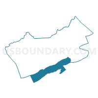
Outline

Summary
| Unique Area Identifier | 682649 |
| Name | Freestone Voting District |
| County | Tazewell County |
| State | Virginia |
| Area (square miles) | 51.44 |
| Land Area (square miles) | 51.39 |
| Water Area (square miles) | 0.05 |
| % of Land Area | 99.90 |
| % of Water Area | 0.10 |
| Latitude of the Internal Point | 37.00899470 |
| Longtitude of the Internal Point | -81.59279170 |
Maps


Graphs
Select a template below for downloading or customizing gragh for Freestone Voting District, Tazewell County, Virginia


Neighbors
Neighoring Voting District (by Name) Neighboring Voting District on the Map
- Burkes Garden Voting District, Tazewell County, VA
- Ceres Voting District, Bland County, VA
- Rich Valley Voting District, Smyth County, VA
- Saltville Voting District, Smyth County, VA
- Thompson Valley Voting District, Tazewell County, VA
Top 10 Neighboring County Subdivision (by Population) Neighboring County Subdivision on the Map
- Southern district, Tazewell County, VA (9,101)
- North Fork district, Smyth County, VA (4,392)
- Saltville district, Smyth County, VA (4,315)
- District 1, Bland County, VA (1,774)
Top 10 Neighboring Unified School District (by Population) Neighboring Unified School District on the Map
- Tazewell County Public Schools, VA (45,078)
- Smyth County Public Schools, VA (32,208)
- Bland County Public Schools, VA (6,824)
Top 10 Neighboring State Legislative District Lower Chamber (by Population) Neighboring State Legislative District Lower Chamber on the Map
- State House District 4, VA (73,375)
- State House District 6, VA (73,250)
- State House District 5, VA (69,572)
- State House District 3, VA (66,212)
Top 10 Neighboring State Legislative District Upper Chamber (by Population) Neighboring State Legislative District Upper Chamber on the Map
Top 10 Neighboring 111th Congressional District (by Population) Neighboring 111th Congressional District on the Map
Top 10 Neighboring Census Tract (by Population) Neighboring Census Tract on the Map
- Census Tract 302, Smyth County, VA (4,658)
- Census Tract 206, Tazewell County, VA (4,358)
- Census Tract 301, Smyth County, VA (3,427)
- Census Tract 402, Bland County, VA (2,923)
- Census Tract 207, Tazewell County, VA (2,885)
Top 10 Neighboring 5-Digit ZIP Code Tabulation Area (by Population) Neighboring 5-Digit ZIP Code Tabulation Area on the Map
- 24370, VA (6,572)
- 24651, VA (6,314)
- 24315, VA (3,774)
- 24318, VA (639)
- 24377, VA (348)
- 24316, VA (50)